


FRESNO (KMJ) — A team from USGS has spent Monday morning in Lost Lake Park, measuring the water discharge from Friant Dam.
“What we’re trying to do is calibrate our ratings”, explains Deputy Data Chief Al Caldwell. “So that the numbers that we’re showing on our website are accurate, and we want to be sure we’re putting out the most accurate information that’s possible for the public.”
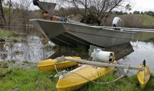
The is water being released in the San Joaquin River, and measurements are taken by a device referred to as an ADCP.
“‘Acoustical Doppler Current Profiler'”, explains Caldwell. “It’s a high-tech piece of equipment that basically reflects off particles in the water and can determine how fast the water is moving at any particular point in the stream.
“So combining the depth and the velocity together we can mathematically come up with a discharge at that point.”
The information collected as part of the program, helps determine the flood risk. That’s then used by the National Weather Service to help predict problems before they arise.
Hear the report from KMJ’s Dominic McAndrew as it aired: